Southern Africa is one of two land-based areas of the planet where large-scale drying is projected to occur in future decades. The projections tell us that this is expected to result from the late onset of the rains. However, much of what we know about the climate dynamics of this remote region depends on numerical models, and is not grounded in observations.
The DRYCAB project aimed to address this observational deficit. A collaboration between the University of Oxford and the Zambian Meteorological Department, the project set out to compile a comprehensive observational dataset on the onset of the rainy season from August to November 2022.
The fieldwork involved setting up two LiDAR systems, one at Solwezi and one at Sakeji Mission School near Ikelenge in far NW Zambia. A total of 784 radiosondes were released on a 3-hourly timetable, 373 at Nchila (3 km from Sakeji) and 411 from Solwezi. A string of AWSs was also established in an arc between the two radiosonde sites of Nchila and Solwezi. The Oxford field team was based at Nchila, while the Zambian Meteorological Department ran the radiosonde station and LiDAR system at Solwezi under the leadership of Wallace Kasongo.
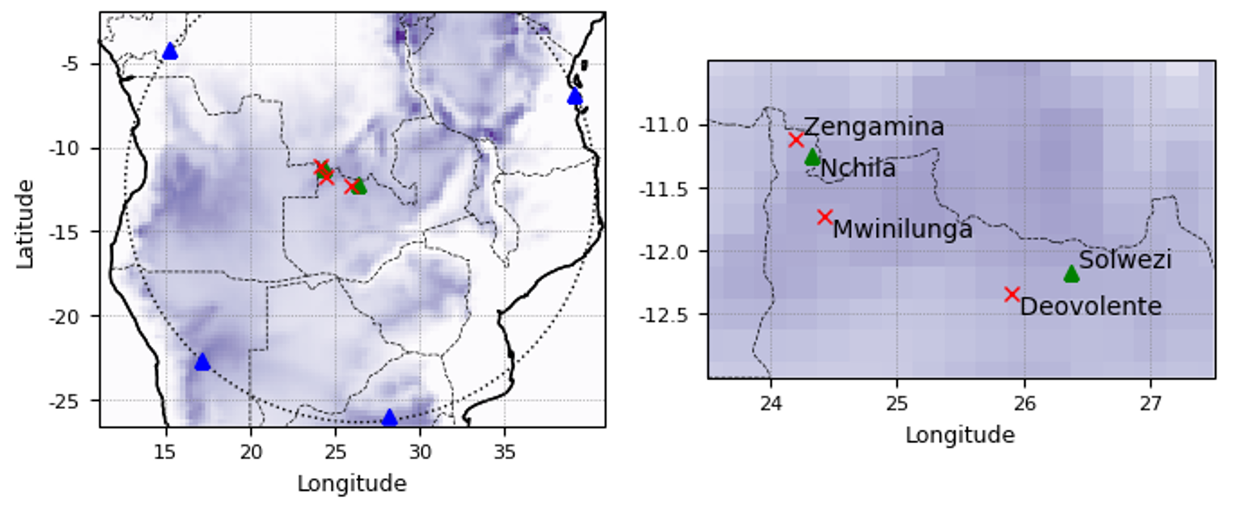
Location of the DRYCAB project field sites. Red cross: Automatic weather station (AWS) only sites; green triangles: radiosonde sites, AWS and LiDAR. Surface pressure is shaded in purple. Blue triangles show active radiosonde stations reporting to the IGRA radiosonde network.
Fieldwork in such a remote region posed unique challenges. Nchila, our base camp, was an off-grid site with no access to electricity. During the dry season, endless blue-sky days were a blessing for for solar generation. But with the field campaign running into the height of the wet season, we quickly found ourselves strictly rationing our electrons to maintain power to the scientific equipment. A schedule of careful battery usage, regular voltage monitoring, and frequent repositioning of solar panels to maintain an optimal angle to the sun was required to keep the show on the road.
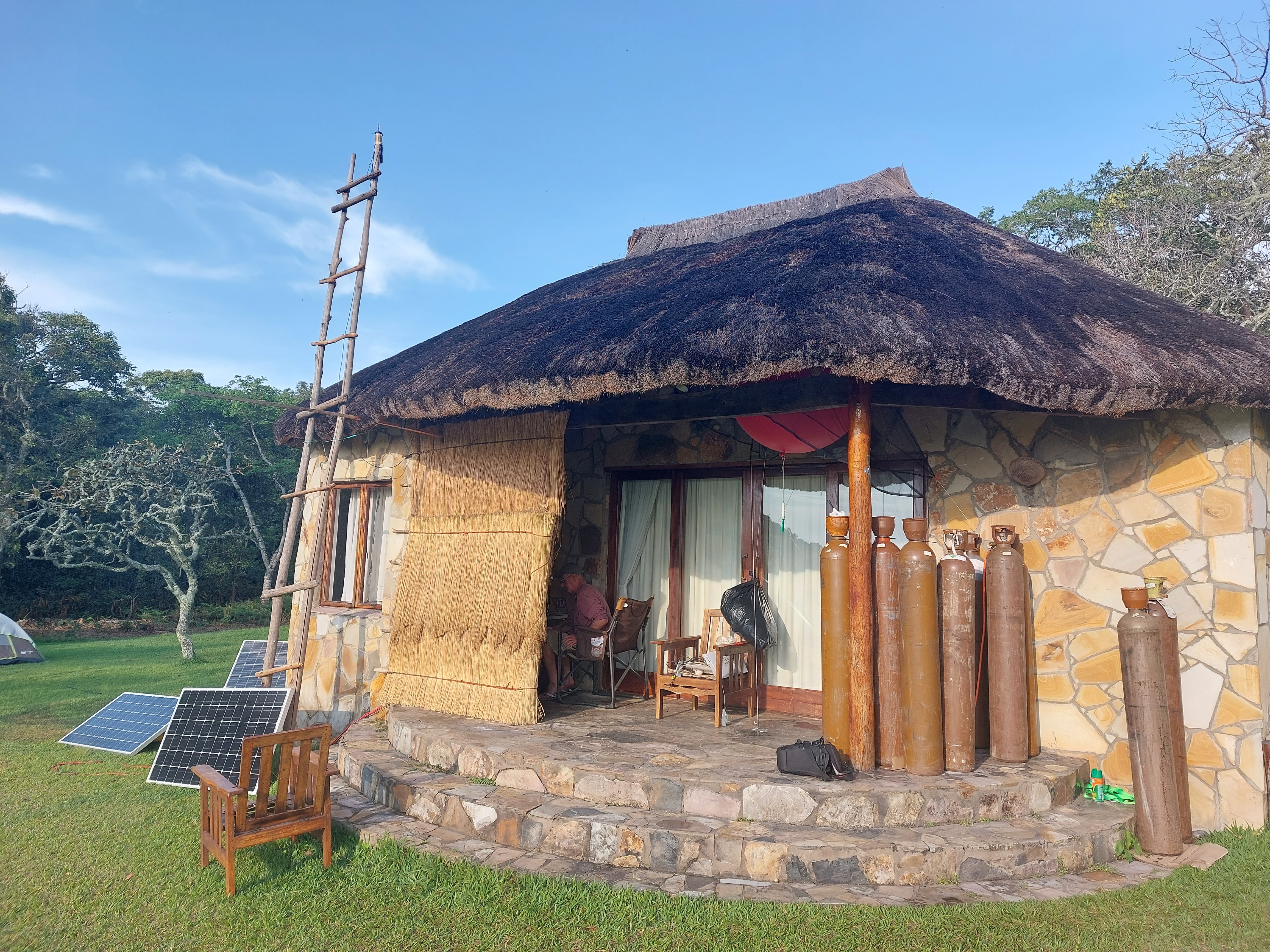
The radiosonde release station at Nchila camp. An off-grid fieldsite with no electricity posed challenges for running the science kit, particularly later in the campaign when clouds limited solar generation.
Living and working in such a remote location for an extended period was a real privilage. With the nearest major town with a supermarket a two-day drive away, isolation brought a unique rhythm to work - as did the 3-hourly radiosonde releases. The constant need to problem solve, troubleshoot and improvise made every day interesting and unique. On many evenings, we were treated to deep red African sunsets. On others, spectacular lightning storms in the distance (or for a couple of particularly sleepless nights, rather uncomfortably close to my tent).
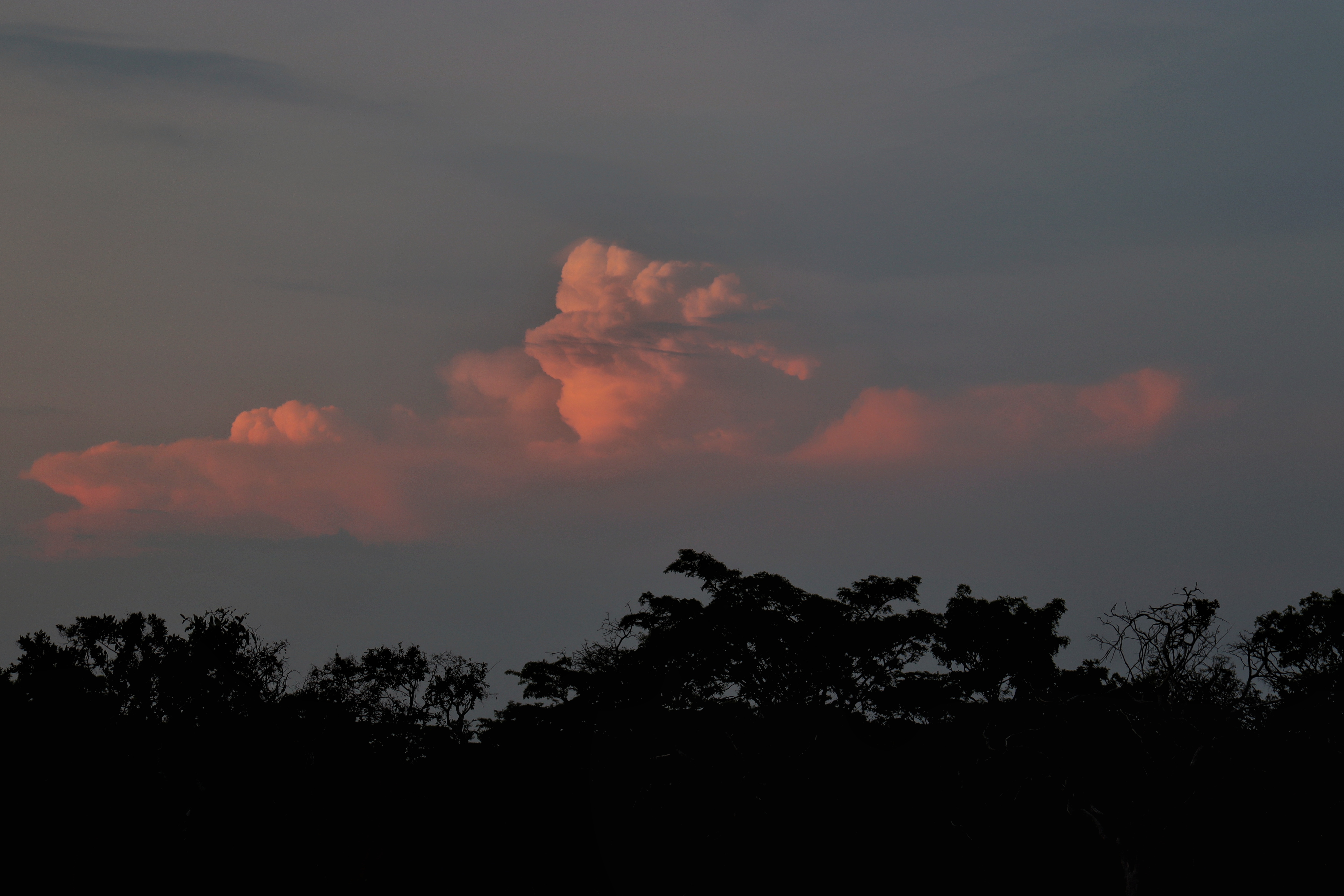
The onset of the rains provided for some spectacular storm systems, both near and far.
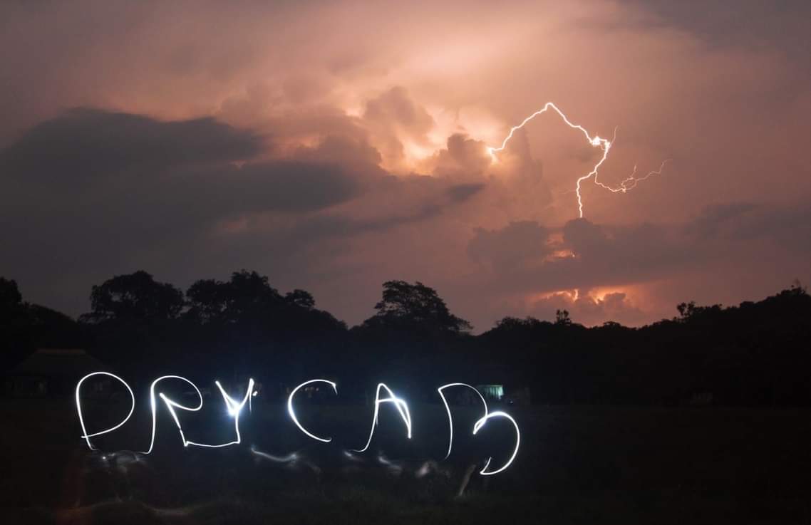
A severe storm to the east of camp (over the Southern Congo Basin) lights up the night sky. In the foreground, I use a headtorch to light-paint the project name.
The DRY-CAB project was funded by the NERC Decreasing Rainfall to Year 2100-Role of the Congo Air Boundary (DRY-CAB) Grant (NE/V011928/1). The project is deeply indebted to the services of Edson Nkonde, Director of the Zambia Meteorological Department, and to Felix Imbwae and Col Rodney Mulenga. Wallace Kasongo and their team led data collection at the Solwezi radiosonde station while the Nchila radiosonde station was supported by Sebastian Engelstaedter, Kitty Attwood, Alice Jardine and Chris Edmunds. Thanks also to Mark Ronald and Doug Hanna at Sakeji School for invaluable practical assistance in the field and Pete and Lynne Fisher of Hillwood Farm for kindly hosting us at Nchila.